In the nearly 25 years since the U.S. Drought Monitor was created, its weekly maps of drought conditions nationwide—which help direct emergency federal aid—have captured the steady march toward the drier, hotter reality of climate change, according to a new Dartmouth-based study.
But the Drought Monitor itself has not adapted to that reality, the researchers report in the journal AGU Advances. Areas of the country are spending more and more time in severe drought conditions the Drought Monitor still considers to be rare occurrences, raising questions about whether and how federal monitoring should account for long-term climate trends.
The consequences could be that swaths of the country—particularly in the West—may not receive aid in keeping with the enhanced risk of drought, despite baking in extreme heat for months. The challenge for federal authorities, the researchers report, is making sure the Drought Monitor remains effective as periodic emergencies become persistent new realities.
“The system we use for emergency response to drought conditions is being co-opted by a changing climate,” says senior author Justin Mankin, a Dartmouth associate professor of geography and director of the Climate Modeling and Impacts Group. He directed the study in his role as co-lead of the National Oceanic and Atmospheric Administration’s Drought Task Force and a NOAA grant supported the research.
“Is it the case that a drought considered ‘exceptional’ today is more severe hydrologically than an ‘exceptional’ drought in 2000 when the Drought Monitor was created? We think that it is, but that wouldn’t be captured by the tool itself,” Mankin says. “What has historically been classified as a severe drought will likely be considered less severe in the future as drought conditions worsen due to human-driven climate change.”
The Drought Monitor is produced by the National Drought Mitigation Center at the University of Nebraska-Lincoln with the U.S. Department of Agriculture and NOAA.
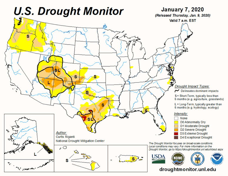
Each week, experts compile analyses to determine the severity of drought experienced at national, state, and regional levels based on precipitation, soil conditions, reservoir levels, temperature, and agricultural losses, as well as reports and advocacy from local politicians and stakeholders. The Drought Monitor then publishes a map with severity denoted by color, from white indicating no drought to maroon signifying extreme conditions.
Policymakers use the Drought Monitor to inform disaster response, enact water restrictions, and offset economic losses for agriculture and municipalities. Government agencies such as the Bureau of Land Management use it to guide policy action, such as restricting outdoor activities, banning outdoor fires, and ordering evacuations ahead of wildfires.
Conditions are classified into six categories based on the frequency they’re estimated to occur. They start with “normal or wet conditions” followed by five stages of drought ranging from D0 (“abnormally dry”) to D4 (“exceptional drought”). The chances of an area experiencing the least severe D0 conditions are roughly 30%. But the likelihood of severe D4 conditions befalling a region is believed to be 2% or less.
“While these percentile thresholds are static, the climate is not,” says Zhiying Li, the paper’s first author and an assistant professor at Indiana University who began the study as a postdoctoral research fellow at Dartmouth. “The ongoing aridification and worsening droughts in certain regions may change what was once perceived as an anomaly, making it less of an emergency anymore.”
The researchers examined real changes from 2000 through 2022 in six climate and hydrological variables that inform the Drought Monitor. They found that “exceptional” D4 droughts have been alarmingly commonplace.

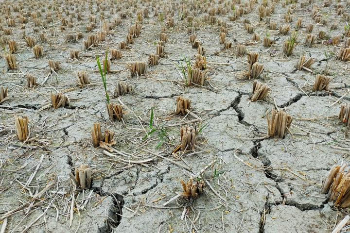
Regions such as the Southwest, the southern Plains, and the Deep South experienced extreme droughts much more frequently than the Drought Monitor guidelines suggest they should. Parts of California were under severe drought conditions for 18% of the 23 years studied—about 4 years in total—or nine times more often than the Drought Monitor estimates.
The result is that sections of the country have been colored maroon for weeks or months on end, Mankin says. “What value to decision-making is a map that is red everywhere all of the time?” he asks.
“Essentially, the amount of time places spend in drought is exceeding federal guidelines that determine how severe a drought is,” Mankin says. “The management system itself needs to adapt or it risks obsolescence.“
The study is intended to illustrate the deviations between the Drought Monitor and climate change, Li says. Reconciling the two will require collaboration between the climate experts who inform the Drought Monitor and the policymakers who rely on it.
”Our interest in reviewing the Drought Monitor classifications stemmed from a recognition of the increasing importance of having reliable drought monitoring and assessment,“ Li says. ”It is imperative to question whether and how our country’s drought assessment and monitoring tools are reflecting the changing climate."
